Development and integration of geopython tools to support Integrated Coastal Management and Maritime Spatial Planning
Stefano Menegon & Alessandro Sarretta
stefano.menegon at ismar.cnr.it
CNR - Institute of Marine Sciences
Muttenz, June 24, 2016
Context: Maritime Spatial Planning
- Maritime Spatial Planning Directive - MSPD (2014/89/EU)
- Planning of coastal and marine areas
- Development of socio-economics activities (Integrated-Use Management) while preserving the environment (Ecosystem-Based Management)
- Suitable tools and geospatial data
Tools to support Ecosystem Based Management
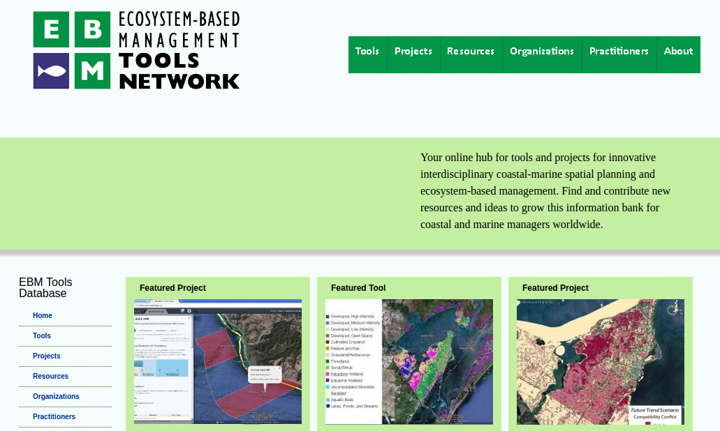 https://www.ebmtoolsdatabase.org/
Tools to support MSP
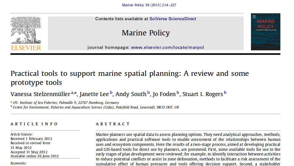
Stelzenmüller, Vanessa, et al. "Practical tools to support marine spatial planning: a review and some prototype tools." Marine Policy 38 (2013): 214-227.
Types of MSP tools
Identifying spatial interactions between activities
Risk assessment of cumulative effects of human pressures
Decision support systems
Web-based vs. GIS-based tools
Designed for different users (programmer, scientist, strategic planner, case officer, public),
To addresse different stages of the plan
ADRIPLAN project
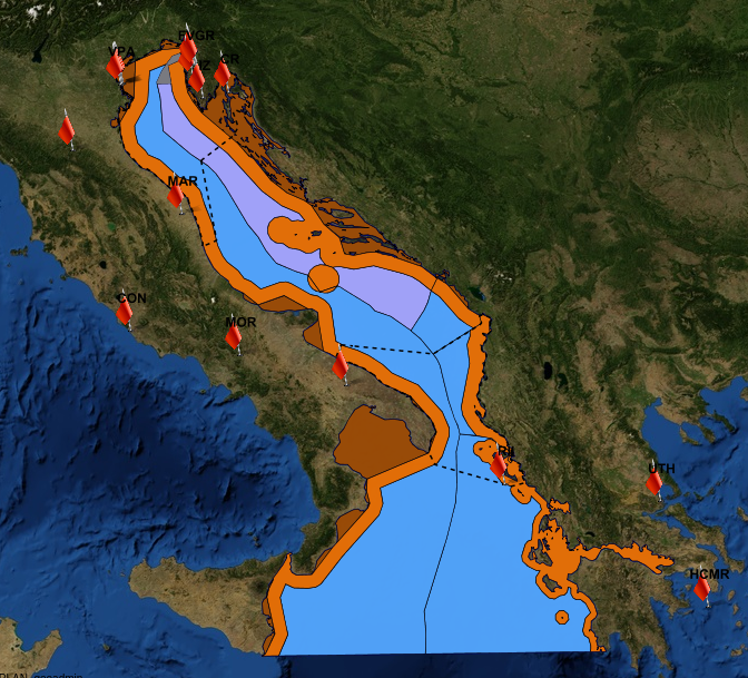
- EU funded project to develop MSP in the Adriatic-Ionian Macroregion
- December 2013 - July 2015
- Transboundary (4 countries: Croatia, Italy, Slovenia, Greece), 8 Scientific Partners and 9 Institutional Partners, 17 observers
- An integrated and collaborative web-infrastructure for publishing, sharing and processing scientifc data
- Actually, the infrastructure and MSP tools are currently under further development
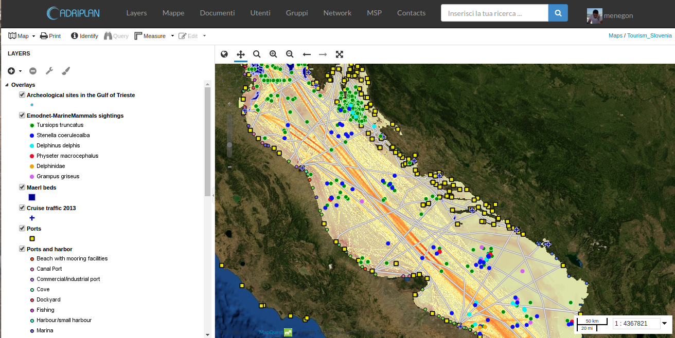
1 - Adriplan Data Portal
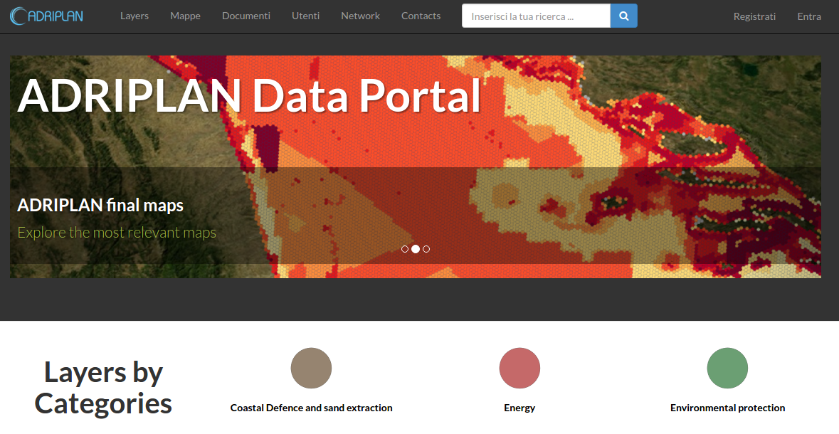
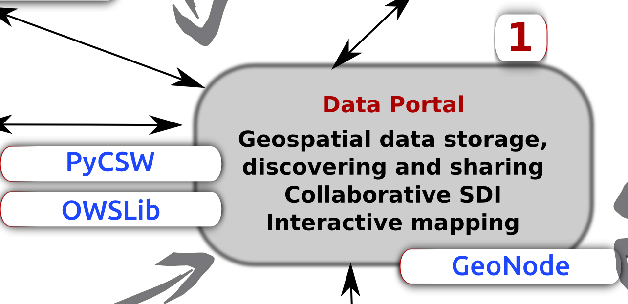
- GeoNode fork: GeoDjango, OWSlib, PyCSW, GeoServer
- Geospatial data storage / archiving, discovering, sharing
- Interoperable services: collaborative SDI
- Granular permissions system
- Interactive mapping
1 - Adriplan Data Portal
- 322 layers (geospatial datasets - raster + vector)
- 113 maps (combination of layers)
- Deal with external OGC-services through "Remote services" functionality
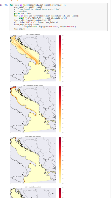
2 - MSPTools
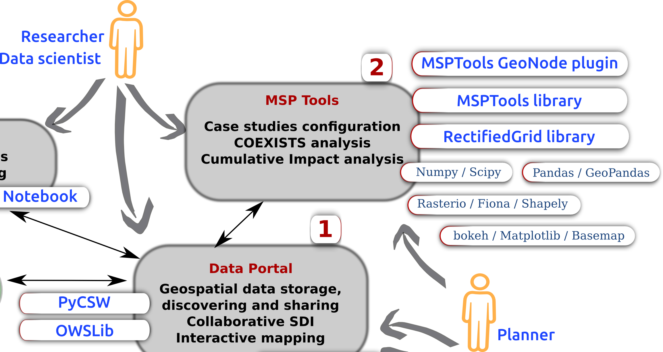
2 - MSPTools
- GeoNode plugin (python)
- Direct interaction with stored data
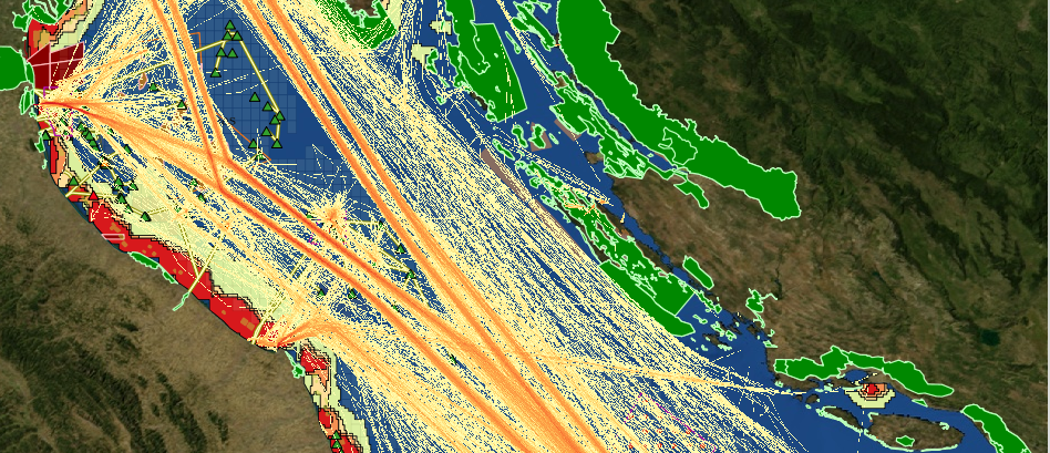
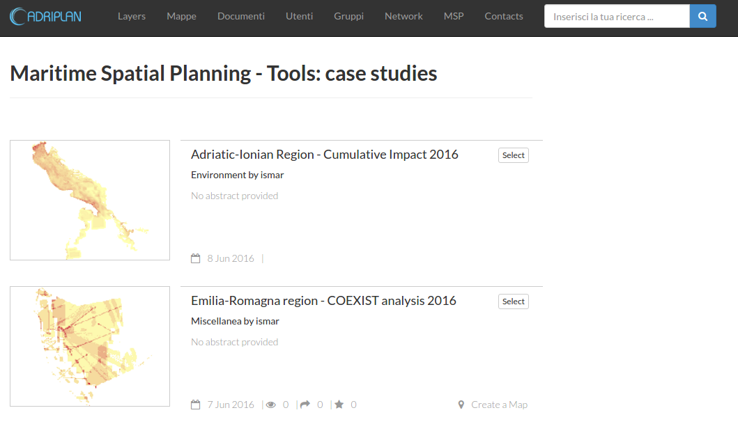
- The users can build several scenarios (called Case Studies) by choosing the analysis area, the data layers, the analysis grid cell
- The output includes: geographical layers, raw data, base statistics and graphs
- The spatial outputs from each run are automatically saved and published through the portal
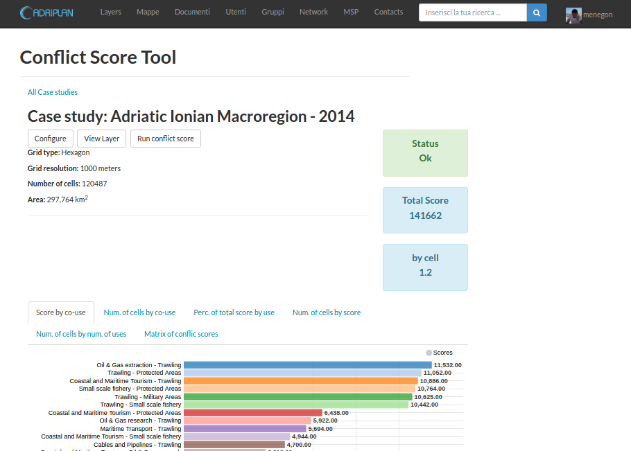
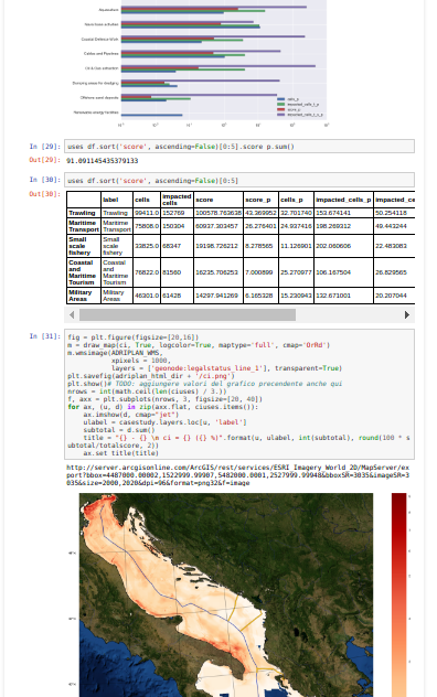
MSPTools - Conflict score
Tool to quantify the overlapping of uses, calculating the direct spatial conflict score based on COEXIST methodology
 http://www.coexistproject.eu/
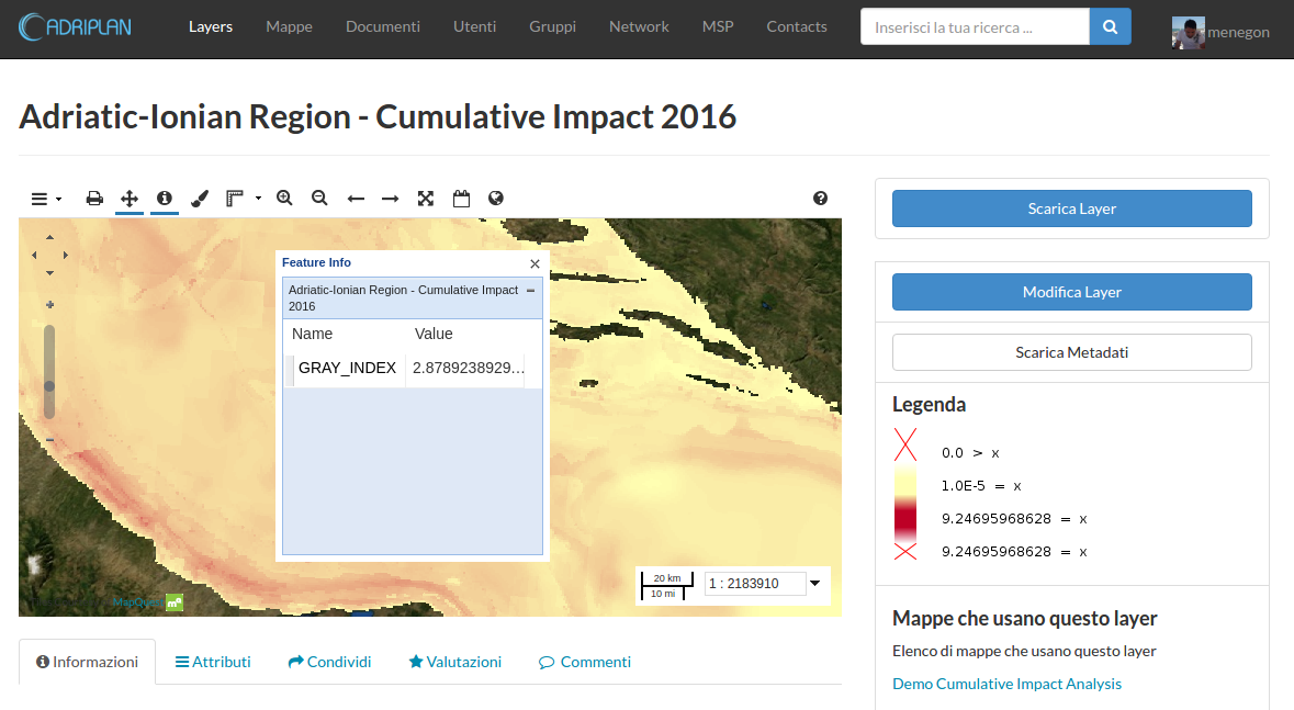
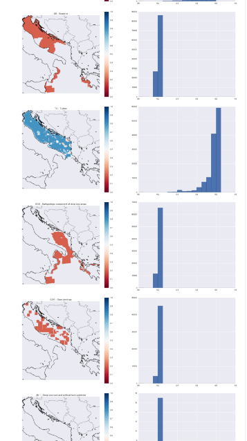
MSPTools - Cumulative impact
Identify areas in the marine space where the environmental components are more exposed to anthropogenic pressures
- Activities and uses (e.g. Maritime transport)
- Environmental components (e.g. Marine mammals)
- Pressures (e.g. Underwater noise)
- Sensitivities: the sensitivity of each environmental component to each pressure generated by a maritime use
firstly introduced by Halpern et al. (2008) at global scale, then implemented in several Marine Regions (Mediterranean by Micheli et al. (2013), Baltic Sea by (Korpinen et al., 2013), and North Sea (Andersen et al., 2013)).
MSPTools - Cumulative impact
$ CI = \sum_{i=1}^l\sum_{j=1}^m\sum_{k=1}^n s(U_i, P_j, E_k) i(U_i, M(U_i, P_j, E_k)) d(E_k)$
modified from Andersen 2013, Human uses, pressures and impacts in the eastern North Sea
- U = Activities and uses
- E = Environmental components
- P = Pressures
- s(U, P, E) = Sensitivities
- i(U, M) = intensity U in the cell in question according to spatial model M
MSPTools - Software packages
- A stack of 3 elements
- MSPTools GeoNode plugin: integrated GUI to create scenarios (Case Studies) and to visualize the outputs, functions to deal with GeoNode data store
- MSPTools library: a geonode-agnostic library that implements the core functionalities (es. Case Study) and the specific tools (e.g. COEXIST, Cumulative Imapct)
- RectifiedGrid: lower level library to deal with raster data
MSPTools - GeoNode plugin
MSPTools - GeoNode plugin
MSPTools - GeoNode plugin
MSPTools - GeoNode plugin
MSPTools - RectifiedGrid
- Geospatial grid-based analyses
- Based on: Numpy, SciPy, shapely, rasterio, fiona, geopandas, owslib, matplotlib-basemaps
- Extends Numpy MaskedArray class by adding geospatial functionalities (i.e. projection awareness, bounding boxes)
- Simply support of "map-algebra" through Numpy syntax (ex. map_a + map_b)
- Input / Output from geospatial formats through rasterio / fiona
- Supports EEA reference grid (based on Lambert Azimuthal Equal Area - 1, 10, 100 km)
3 - Analysis, Rapid prototyping
Jupyter notebook, reusable ".ipynb" files
5 - Desktop applications: GeoServer Explorer
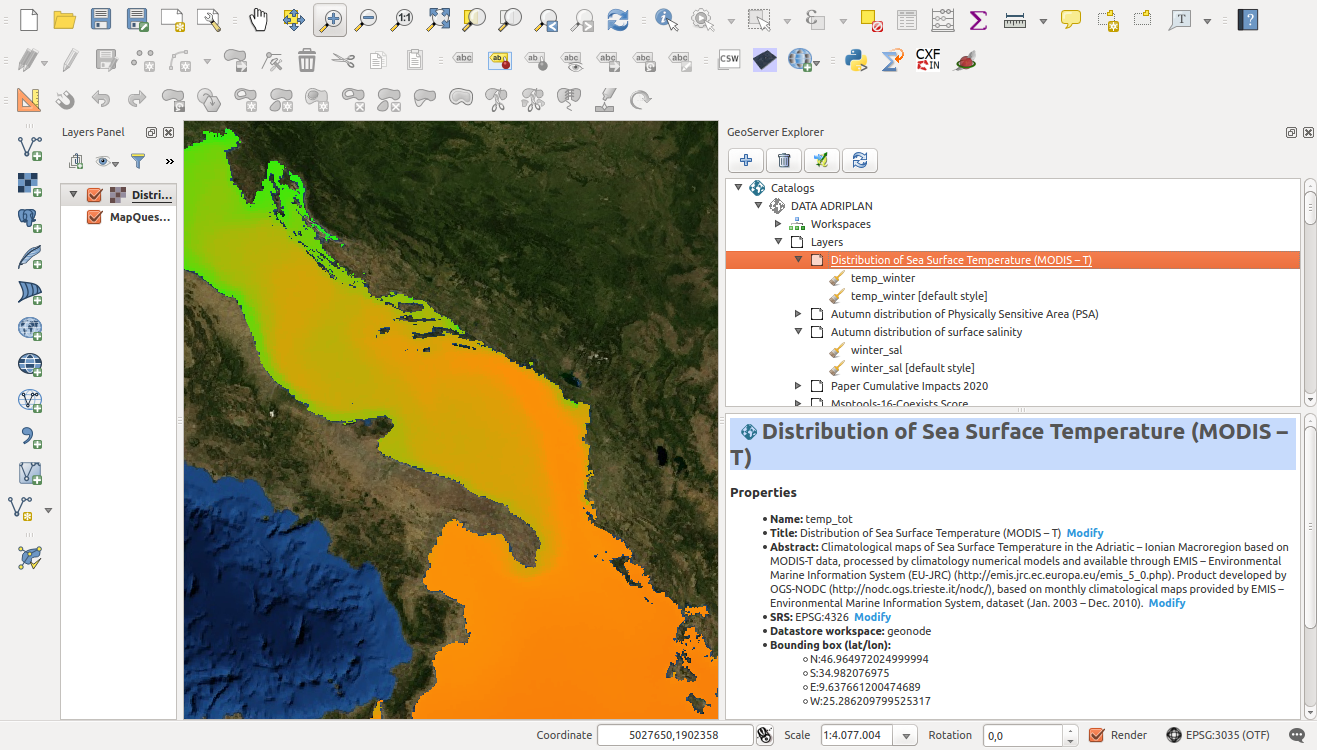
QGis GeoServer Explorer plugin: to configure GeoServer through QGis (e.g. manage layers, upload new layers, create a manage styles)
http://boundlessgeo.github.io/qgis-plugins-documentation/geoserver/Future steps
- Improve the integration in the ADRIPLAN data portal
- Interactive dashboard for summary/statistics (e.g. Bokeh)
- Add a WPS service (e.g. PyWPS)
- Performance optimization through specific formats for storage (HDF5, numpy.memmap)
- Add new modules related with the MSP process (e.g. scenario planning and analysis, socio-economic aspects)
- Support more advaced spatial analyses (e.g. PyGRASS)
- Releas all the softwares as open source
Development and integration of geopython tools to support Integrated Coastal Management and Maritime Spatial Planning
by S. Menegon & A. Sarretta is licensed under a Creative Commons Attribution 4.0 International License.