Open source tools to support Integrated Coastal Management and Maritime Spatial Planning
Stefano Menegon¹, Alessandro Sarretta¹, Andrea Barbanti¹, Elena Gissi², Chiara Venier¹
stefano.menegon at ismar.cnr.it
¹CNR - Institute of Marine Sciences
²University IUAV of Venice
Perugia, October 13, 2016
Background: Maritime Spatial Planning
- MSP: planning of coastal and marine areas
- It's about planning when and where human activities take place at sea – to ensure these are as efficient and sustainable as possible - Maritime Spatial Planning Directive - MSPD (2014/89/EU)
- Development of socio-economics activities (Integrated-Use Management) while preserving the environment (Ecosystem-Based Management)
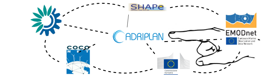
Background: ADRIPLAN project
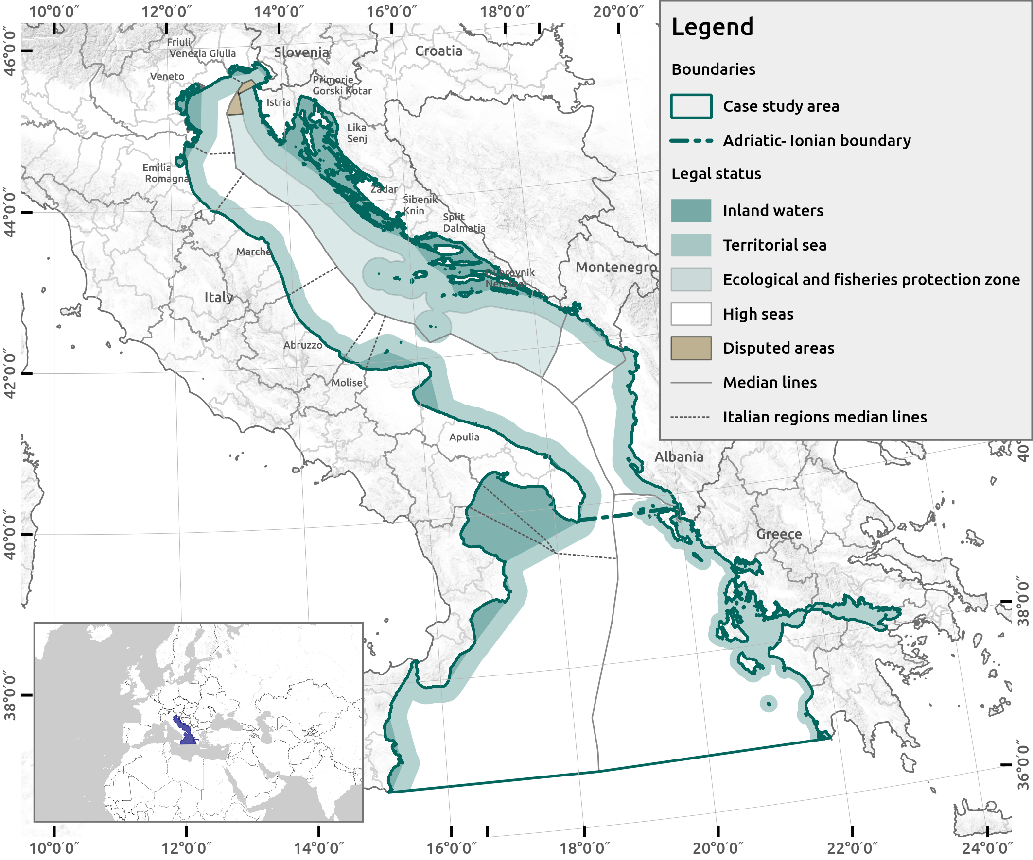
- EU funded project to develop MSP in the Adriatic-Ionian Macroregion
- December 2013 - July 2015
- Transboundary (4 countries: Croatia, Italy, Slovenia, Greece), 8 Scientific Partners and 9 Institutional Partners, 17 observers
MSP Issues & Requirements
 Analysis: Daniel Depellegrin (CNR-ISMAR)
- Relevant and multidisciplinary data, collected from different sources (i.e. regions, countries)
- A complex process involving a community of experts, planners, stakeholders, etc. etc.
Tools to support MSP: review
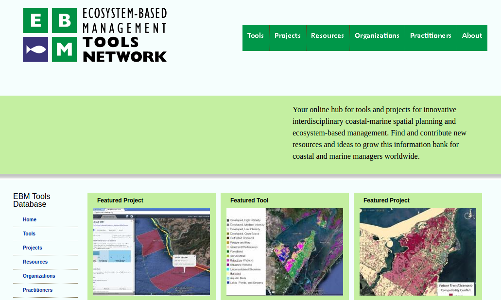
Types of MSP tools
- Identifying spatial interactions between activities
- Risk assessment of cumulative effects of human pressures
- Decision support systems
Web-based vs. GIS-based tools
Designed for specific users (programmer, scientist, strategic planner, case officer, public),
To address specific stages of the plan
ADRIPLAN approach
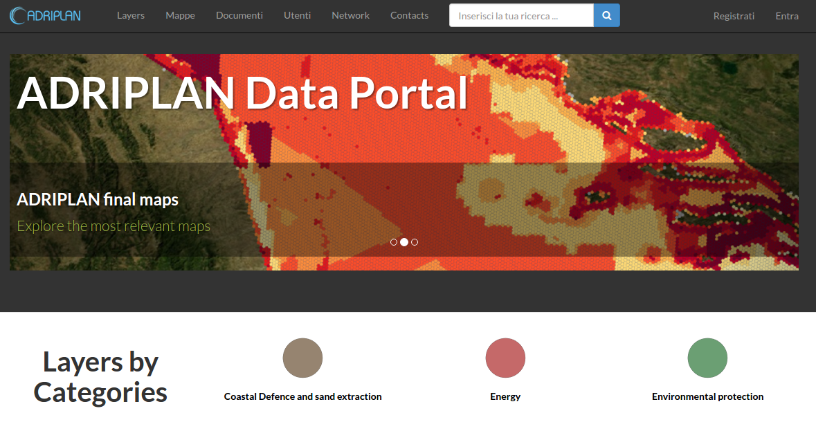
- ADRIPLAN Portal: an integrated and collaborative SDI and a web-based platform for publishing, sharing and processing MSP data
- Tools4MSP: a set of web and open source tools developed to support the MSP activities
- The infrastructure and Tools4MSP are currently under further development
1 - Adriplan Data Portal
- 330 layers (geospatial datasets - raster + vector)
- 120 maps (combination of layers)
- Deal with external OGC-services through "Remote services" functionality
- Direct interaction with stored data
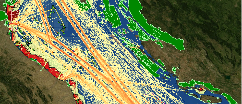
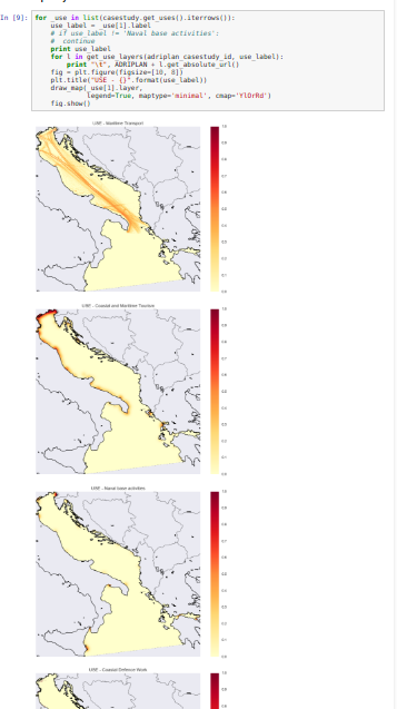
- The users can build several scenarios (called Case Studies) by choosing the analysis area, the data layers, the analysis grid cell
- The spatial outputs from each run are automatically saved and published through the portal
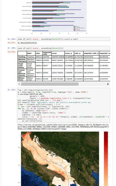
Tools4MSP - Conflict score
Tool to quantify the overlapping of uses, calculating the direct spatial conflict score based on COEXIST methodology
 http://www.coexistproject.eu/
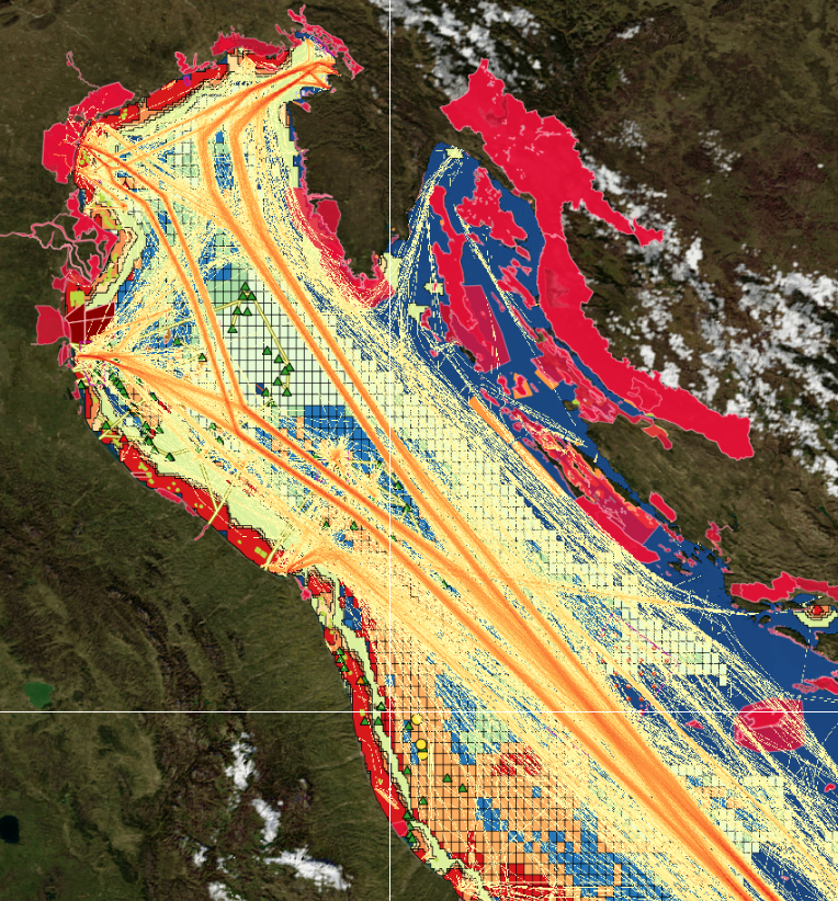
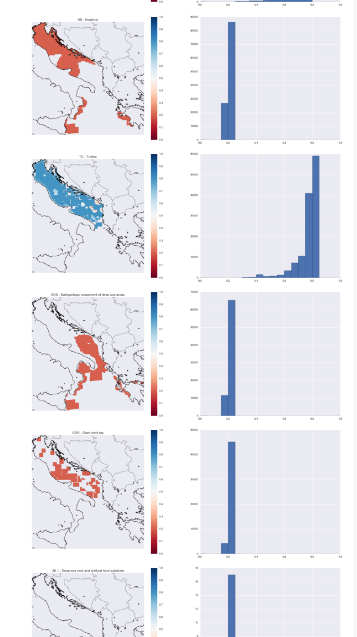
Tools4MSP - Cumulative impact
Identify areas in the marine space where the environmental components are more exposed to anthropogenic pressures
- Activities and uses (e.g. Maritime transport)
- Environmental components (e.g. Marine mammals)
- Pressures (e.g. Underwater noise)
- Sensitivities: the sensitivity of each environmental component to each pressure generated by a maritime use
firstly introduced by Halpern et al. (2008) at global scale, then implemented in several Marine Regions (Mediterranean by Micheli et al. (2013), Baltic Sea by (Korpinen et al., 2013), and North Sea (Andersen et al., 2013)).
E. Gissi, S. Menegon et al. submitted
Tools4MSP - Cumulative impact
$ CI = \sum_{i=1}^l\sum_{j=1}^m\sum_{k=1}^n s(U_i, P_j, E_k) i(U_i, M(U_i, P_j, E_k)) d(E_k)$
modified from Andersen 2013, Human uses, pressures and impacts in the eastern North Sea
- U = Activities and uses
- E = Environmental components
- P = Pressures
- s(U, P, E) = Sensitivities
- i(U, M) = intensity U in the cell in question according to spatial model M
3 - Analysis, Rapid prototyping
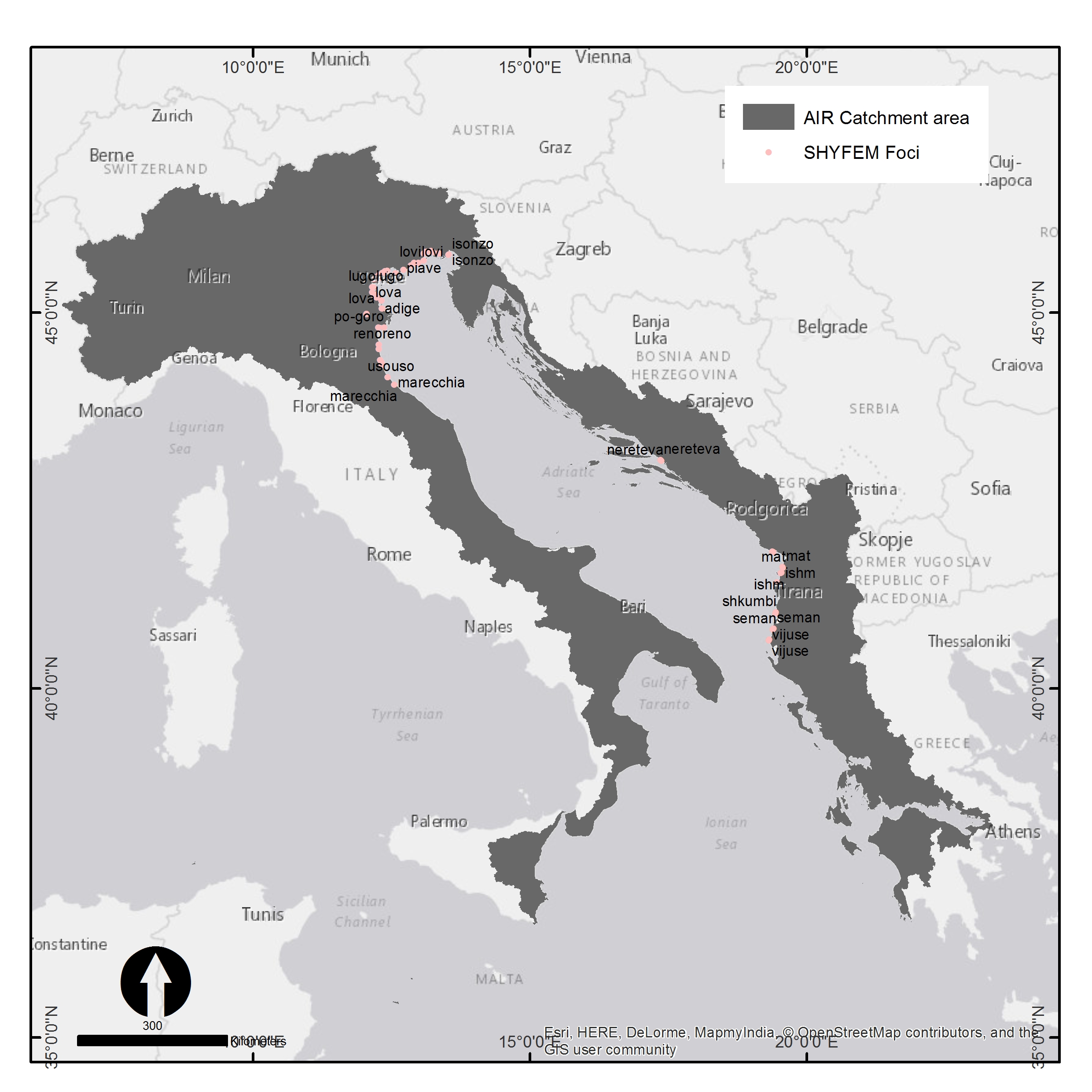
Jupyter notebook, reusable ".ipynb" files
5 - Desktop applications: GeoServer Explorer
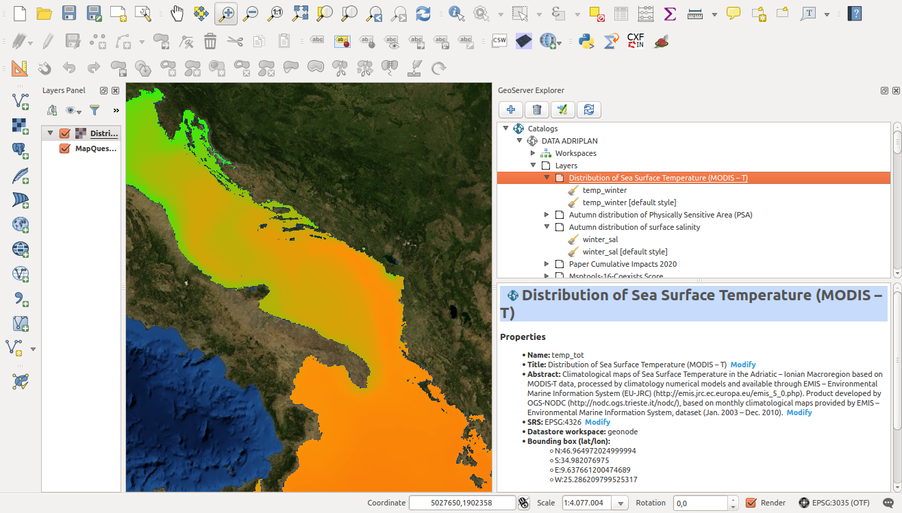
QGis GeoServer Explorer plugin: to configure GeoServer through QGis (e.g. manage layers, upload new layers, create a manage styles)
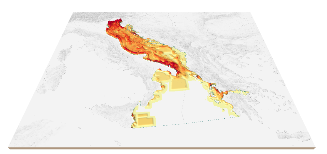
http://boundlessgeo.github.io/qgis-plugins-documentation/geoserver/3D visualizazion of the Cumulative Impact
Qgis2Threejs plugin
Future steps
- Add new analysis tools (e.g. ecosystem services, scenario planning and analysis, socio-economic aspects)
- Finalize a downloadable ready-to-use analysis package: data + software (i.e. Tools4MSP library & Rectifiedgrid)
- Support more advaced spatial analyses softwares and frameworks(e.g. PyGRASS)
- Improve interoperability functionalities (e.g. add a WPS service)
- Performance optimization through specific formats for storage (HDF5, numpy.memmap)
Development and integration of geopython tools to support Integrated Coastal Management and Maritime Spatial Planning
by S. Menegon, A. Sarretta, A. Barbanti, E. Gissi & C. Venier is licensed under a Creative Commons Attribution 4.0 International License.